

US
°C


Wesley pummeled the Plains with blizzard conditions and gusty winds. More than 30 inches of snow fell in the Dakotas.
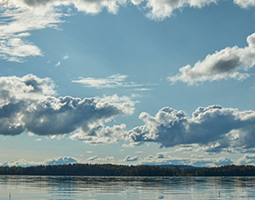
Winter Storm Wesley brought a blizzard to the Plains, more than two feet of snow to the Dakotas, an ice storm to parts of several Midwestern states and even a dust storm to the southern Plains.
Wesley set all-time two- and three-day snowstorm records in Watertown, South Dakota, where 23.2 inches fell from April 10-11 and 25 inches was the final snowstorm total from April 10-12. This topped the previous record of 20 inches set during a late March 1937 snowstorm, there.
This snow vaulted Watertown, and two other South Dakota cities, to their .
Huron, South Dakota, set a new April two-day snowstorm record for the second year in a row, picking up 18 inches of snow April 10-11, topping the two-day total of 15.5 inches from in April 2018.
Mitchell, South Dakota, tied its two-day April record, also set during Xanto in 2018, picking up 16.2 inches.
Totals and preliminary track of Winter Storm Wesley
(MORE:Impacts From Wesley)
Winter Storm Wesley was named on April 8 with the expectation that both population and areal criteria would be met across the Plains and Midwest. By April 10, blizzard warnings were issued for more than 3.9 million people and 455,000 square kilometers, satisfying the criteria without even including other winter storm and ice storm warnings.
Wesley did not strengthen enough to meet the most commonly used definition of "bomb cyclone," which is a surface-pressure drop of 24 millibars in 24 hours. However, if you adjust for latitude, Wesley has strengthened sufficiently to NOAA Weather Prediction Center senior forecaster noted in a tweet. According to Weather Underground meteorologist , nontropical low-pressure systems tend to be weaker at lower latitudes. The that coined the term "bomb" therefore suggested adjusting the more common definition by latitude.
Here's a day-by-day recap of Wesley:
Wesley developed within a deep dip in the jet stream located over the Pacific Northwest and Great Basin. Snow fell from Washington and Montana southward to the central Rockies and into the northern Plains.
Rain stretched eastward through South Dakota, Iowa and Illinois.
Cold air spread southward into much of the Plains early in the day as the center of Wesley spun south and eastward over the central Rockies. Snow spread across much of Wyoming, Colorado and Utah while becoming more widespread over the central Plains and Midwest.
Thundersnow was reported early Wednesday in parts of South Dakota, including Pierre, the state's capital city.
Winds increased during the day from northern Mexico across the southern Rockies and southern Plains, gusting as high as 80 mph in parts of the Texas Panhandle and New Mexico.
The gusty winds in New Mexico fueled near Portales that destroyed four buildings and injured one person. by the strong winds Wednesday from northern Mexico and southeastern Arizona to southeastern New Mexico and the Texas Panhandle, .
Power lines were taken down by strong winds near Amarillo, Texas, late Wednesday afternoon. A lumber store in Tucumcari, New Mexico, lost part of its roof in high winds early Wednesday evening.
Wesley pivoted across the Central Plains and into the Midwest, bringing heavy snow from Colorado to Minnesota.
Blizzard conditions were reported in several Plains states.
Blizzard conditions – frequent gusts at or above 35 mph and visibilities less than 1/4 mile for at least three hours –were recorded in Aberdeen, Huron and Winner, South Dakota. Watertown, South Dakota also recorded blizzard conditions for several hours with intermittent thunder – a thunderblizzard.
Near-blizzard conditions were recorded in Sterling, Colorado; McCook, Nebraska; Pierre and Mitchell, South Dakota; and Minneapolis and Fergus Falls, Minnesota.
from central Nebraska to northeast Wisconsin. A severe thunderstorm dropped , Minnesota, an area .
Heavy icing in northwest Iowa and southern Minnesota and in central Iowa.
Worthington, Minnesota lost power Thursday morning due to a half inch of ice on power lines and other exposed surfaces.
Wesley brought dust and dirt from northern Mexico as far north as the Minneapolis metro area as it crossed the Plains.
Wesley weakened as it trotted through the Upper Midwest bringing lighter snow to the Dakotas, Minnesota and northern Michigan. The last few flurries fell late during the day into the early morning hours of April 13.
It's cold front to parts of the Upper Ohio Valley early during the day.
Here are the highest snowfall totals:
Colorado: 15 inches near Winter Park; 2.5 inches at Denver Int'l AirportIowa: 5 inches in Lansing; 0.25 inches of ice in Lake ParkKansas: 1.5 inches in OakleyMichigan: 10 inches in Three Lakes; 4.5 inches near Iron MountainMinnesota: 17 inches in Ortonville; 9.7 inches at Mpls./St. Paul Int'l Airport; up to an inch of ice in Mountain LakeMontana: 23 inches at Badger PassNebraska: 16 inches near Eli; 12 inches near Chadron; 10 inches at Sidney; 0.25 inches of ice near BassettNorth Dakota: 17.5 inches in Havana; 9.5 inches near FargoSouth Dakota: 30 inches in Terry Peak; 23 inches near Huron; 0.25-0.75 inches of ice at many spots in the southeastern corner of the stateUtah: 26 inches at AltaWisconsin: 12 inches at Townsend; 11.3 inches in Wausau and Eau Claire; 6 inches in Oshkosh; 0.25 inches of ice near EastmanWyoming: 18 inches near Alta; 8 inches in Cheyenne
Here are the highest wind gusts that have been reported so far:
Colorado: 107 mph () in Pueblo West; 76 mph in Wolf Creek PassIowa: 64 mph in OelweinMinnesota: 66 mph in St. Paul; 63 mph near DuluthNebraska: 62 mph in Broken BowNevada: 69 mph at Ruby ValleyNew Mexico: 77 mph near ClovisTexas: 88 mph at South Franklin PeakUtah: 85 mph at Deer Valley


 zpostcode
 Recruit
 weather
 mreligion
 Yellowpages
 sport
sport constellation
 shopping
 name
name game
game directory
 literature
 Word
Word tour
tour furnish
 Lottery
 tftnews
 lyrics
 News
News digital
 car
car dir
dir Edu
Edu Finance


