

US
°C


Temperatures are expected to be above average in much of the South this winter. The Northwest has the highest odds of seeing colder-than-average temperatures.Precipitation will split between wet across the northern states and dry through the South.La Niña may play a role in the weather conditions this winter.
Winter 2017-2018 will feature a nationwide split between colder-than-averageand wet conditions in parts of the northern states, while the southern tier will see warmer-than-average and dry conditions overall, according to outlooks released this week byNOAA and The Weather Company, an Business.
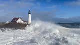
Pedestrians walk in the snow and wind on Feb. 9, 2017 in the Brooklyn borough of New York City during Winter Storm Niko. (Spencer Platt/Getty Images)
Weak La Niña conditions are expected to develop this winter, and that may influence the large-scale weather conditions this winter ahead. Last week, NOAA indicated there was a 55 to 65 percent chance of La Niña conditions during theupcoming winter.
Winter (December through February) temperature outlooks from both The Weather Company and NOAA feature some similarities for what is typically expected in a LaNiña winter.
“As is typical in La Niña base state winters, we expect the greatest risk of cold early in the winter in the eastern U.S., with the cold retreating towards the Pacific Northwest as the winter progresses,” saysDr. Todd Crawford, chief meteorologist with The Weather Company.
(MORE: )
La Niña, El Niño, or the lack of either, known as the neutral phase, is only one large-scale forcing on the atmosphere. It is not arbiter in determining whether a season is wet, dry, cold or warm. Other factors are in play, includingatmospheric blocking.
Below are the national details on what to expect.
The temperature forecast for this winter has a with the highest odds of below-average temperatures from the Upper Mississippi Valley to the Pacific Northwest.
Warmer-than-average temperatures are most likely to be found across the southern tier of the United States. A mild winter is typical throughout the South during LaNiña winters.
The red contour in the South corresponds to higher probabilities of above-average temperatures. The darker blue areas in the Northwest and Upper Midwest have the highest odds of below-average temperatures. The light blue and orange contours show where temperatures may be slightly below or slightly above average, respectively.
(The Weather Company, an Business)
Since last winter featured a weak La Nina, Crawford says it’s reasonable to use it as an analog for this winter’s forecast.
Last winter, much of the East into the South and Midwest had one of their warmest winters while the Northwest was colder-than-average.
Two of thetop 10 warmest wintersdating to 1895 in the Lower 48 have occurred in back-to-backyears. Last winter was the .
However, Crawford cautioned against simply assuming last winter will repeat itself exactly this winter, ifthis winter hasmore blocking weather patterns in the upper atmosphere.
One particular blocking weather pattern would feature a southward dip in the jet stream east of the Rockies that could “lock in” for extended periods of time, leading to shivering results.
“The colder winter scenario would be if blocking emerges early and often, which would result in more widespread and anomalous cold across the major heating demand regions of the eastern U.S.,” Crawford added.
On the other hand, if a less blocking scenario panned out, conditions would be similar to last year with below-average temperatures confined to the Pacific Northwest.
Keep in mind, these outlooks are overall trends over a three-month period from December-February.
An individual cold front or an upper ridge of high pressure can lead to a period of colder or warmer weather, respectively, that bucks the overall three-month trend. The same front or area of high pressure can bring a brief period of enhanced precipitation or dry spell that may or may not be indicative of the overall trend that is forecast.
NOAA's precipitation forecast also has some correlation with what is expected in aLa Niña winter.
Portions of the Ohio Valley, Great Lakes and northern Rockies have the highest odds of above-average precipitation this winter. Depending on temperatures at any given time this winter, we could see increased odds of snow in those regions.
Meanwhile, the South could be in for a dry winter, which is typical during La Niña. If this pans out as forecast, there is the possibility of growing drought conditions in parts of the Southeast, and it may also give a boost to wildfire danger in this region next spring.
Dark green shaded areas in the Great Lakes, Ohio Valley and the northern Rockies have the greatest odds for above-average precipitation this winter. Locations highlighted in dark brown across the South have the highest probability of drier-than-average conditions. Areas not shaded have an equal chance of seeing precipitation below, above or near average.
(NOAA)
(MORE: )
La Niña/El Niño, the periodic cooling/warming of the equatorial eastern and central Pacific Ocean, can shift weather patterns over a period of months, bringing the possibility of more sustained warm, cold, wet or dry weather in parts of the world.
Sea-surface temperature anomalies in the equatorial central and eastern Pacific Ocean on Oct. 18, 2017. The general area which is monitored for La Niña or El Niño is highlighted by the rectangle.
Sea-surface temperatures in the equatorialPacific Ocean have been running below average recently. That is why NOAA is forecasting the potential forLa Niña conditions to develop later this fall or winter.
You can see the patch of cooler-than-average watersin place across the equatorial Pacific waters shadedblue in the image to the right. Though water temperatures are below average, they have not reached the threshold for a La Niña event quite yet.
The peak atmospheric response to the equatorial Pacific anomalies tends to occur in the Northern Hemisphere's winter months. This is why the possible development of La Niña or its counterpartEl Niñoreceives a large amount of attention prior to winter.
(MORE: )
During last winter's weak La Niña, the West and Upper Midwest had one of their wettest winters on record, while a large swath of the East, South and Midwest had one of their warmest winters.
Winter 2015-2016 featured a strongEl Niño that had major weather pattern impacts around the world.
It's important to note thatLa Niña/El Niño is not a factorevery winter since many times equatorial Pacific sea-surface temperatures run near average, meaning so-called neutral conditions exist.


 zpostcode
 Recruit
 weather
 mreligion
 Yellowpages
 sport
sport constellation
 shopping
 name
name game
game directory
 literature
 Word
Word tour
tour furnish
 Lottery
 tftnews
 lyrics
 News
News digital
 car
car dir
dir Edu
Edu Finance


