

US
°C


Winter 2018-19 had a mix of impressive snowstorms and cold outbreaks.Parts of the Plains and upper Midwest were hit hard by a number of storms.Perhaps the most memorable East Coast storm happened in November.The Desert Southwest had a number of rather bizarre snowfalls.
Winter 2018-19 had it all, from snow in strange places and strange times of year, to bitter cold outbreaks.
It got off to an early start, well before winter officially began, eased a bit, then kicked into high gear with a parade of snowstorms and two notably bitter cold outbreaks before wrapping up with a pair of intense Plains blizzards – and snow even past Easter.
(MORE: 5 Worst Winter Locations in 2018-19)
Just days after hammered the Florida Panhandle and south Georgia, the earliest-in-season snowfall on record blanketed Kansas City and Wichita, Kansas. It was the .
Strangely enough, while this snow event reached as far south as the Texas Panhandle, parts of Alaska had a of the season.
Snow cover analysis on Oct. 15, 2018, the most expansive North American snow cover for the date since 2005.
on record in the Mississippi Valley and Plains wrung out .
New York City was surprised with its , their first such storm in November since 1938, gridlocking the commute home on November 15.
November wrapped up with , the since the late 1960s.
It wasn't all about snowstorms and cold.
In January, a 300-foot-wide spinning disk of ice formed in a river in Westbrook, Maine. Triggered by cooled water forming a vortex, the ice disk quickly went viral in social media.
It became so beloved that when it was temporarily stuck.
The giant spinning ice disk on the Presumpscot River in Westbrook, Maine, in January 2019.
(Jack Milton/Newsflare)
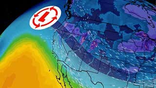
Fueled by a weakening of the stratospheric polar vortex, a sent temperatures plunging into the 20s, 30s, even 40s below zero in the Midwest.
Chicago narrowly missed their all-time record low, but . One location in northern Minnesota plunged to minus 56 degrees.
Wind chills in the 60s below zero were observed in parts of Minnesota, and a phenomenal minus-82-degree wind chill was documented in northern Canada.
Seattle averages only about 5 to 6 inches of snow each year. In early February, though, they were slammed with three separate winter storms.
dumped up to 12 inches near Everett, Washington, but only 2.7 inches at Seattle-Tacoma International Airport.
Four days later, dumped almost 8 inches at SeaTac Airport, followed almost immediately by 9.6-inch snowfall. In all, 20.2 inches piled up in Seattle, their snowiest month in 50 years.
Pedestrians walk near Pike Place Market as snow falls Monday, Feb. 11, 2019, in downtown Seattle. Schools were closed across Washington state as winter snowstorms continued pummeling the Northwest.
(AP Photo/Ted S. Warren)
Las Vegas had three separate snow events in February, punctuated by the on Feb. 20-21.
Tucson, Arizona, rang in the new year with their first measurable snow since 2013, then topped that with from in late February.
Quiana also crushed the , Arizona, dumped snow in the suburbs of Phoenix, and even produced some flakes of snow on some Southern California beaches.
Multiple feet of snow in the Sierra Nevada mountains is the norm during most winters, and a crucial contributor to California's water supply as the snow melts during the late spring/summer dry season.
But by the end of February, even the most ardent snow fans may have been crying uncle.
In , the Sierra picked up almost 8 feet of snow. In , another 11 feet. Near the , you guessed it, more feet.
picked up an incredible 207 inches of snow in February, their snowiest February on record.
One NOAA estimate suggested from October through April in the Sierra.
There was nothing springlike about how March kicked off in the nation's heartland. Bitter subzero cold plunged into the Rockies, Plains and Midwest in .
Montana notched a preliminary all-time state record low for March when the temperature fell to minus 46 degrees in Elk Park March 4. All-time March record lows were also set in North Platte, Nebraska, and Pullman, Washington. Rochester, Minnesota, didn't rise above zero for 36 straight hours.
Wind chills in parts of Montana plunged into the .
A sampling of some of the notable low temperatures during the early March 2019 cold outbreak.
smashing of all-time low-pressure records in the Plains, blizzard conditions, and as far south as New Mexico and Texas were all impressive enough.
The ultimate calling card of this storm, however, was the rapid snowmelt and rain that triggered , particularly in Nebraska and Iowa.
Perhaps the most surreal site of this winter season was of on Nebraska's Niobrara River, which unleashed a wave of water and invading surrounding towns and farmland.
smashed April, even all-time snowstorm records in parts of eastern South Dakota, dumping over 2 feet of snow in many areas of The Mount Rushmore State.
What some meteorologists may remember most, though, was a adding a layer of dust to the snow in parts of the upper Midwest.
Mid-late April featured two stripes of upper Midwest snow that were largely an irritant for those longing for spring warmth.
A was not only one of Chicago's heaviest snowfalls so late in spring, but was accompanied by lightning. At O'Hare, the storm almost satisfied criteria for a blizzard.
Less than two weeks later, was the record latest-in-spring snowfall of 2 inches or more in both Chicago and Rockford, Illinois.
Following early April's Winter Storm Wesley, the National Weather Service in Grand Forks, North Dakota, pointed out that in various parts of their forecast area covering eastern North Dakota and northwest Minnesota, all occurring from late December through mid-April.
For most of us, one such storm a winter season would be memorable. But in this area known as , one to two blizzards are typical each season.
This wasn't even a record. in this part of the northern Plains in both the 2013-14 and 1996-97 winter seasons.
The National Weather Service has a forecast office in the town of Caribou which serves a swath of northern Maine.
Average annual snowfall is 111.9 inches, just over 9 feet. So, the climatological bar is already set pretty high.
In January, Caribou missed tying their all-time record snowy month by one-tenth of an inch, picking up 59.8 inches of snow.
The epic amount of snow created surreal scenes at the NWS office, including north of the office, and a back exit buried after removing snow from the office's roof.
Caribou , which lasted from the day before Veterans Day through Easter.
In just 12 days after April 10, all remaining 27 inches of Caribou's snow cover melted, in what may be the most fitting way to end another amazing winter season in the U.S.


 zpostcode
 Recruit
 weather
 mreligion
 Yellowpages
 sport
sport constellation
 shopping
 name
name game
game directory
 literature
 Word
Word tour
tour furnish
 Lottery
 tftnews
 lyrics
 News
News digital
 car
car dir
dir Edu
Edu Finance


