

US
°C


The next weather system could bring snow to the Midwest beginning Wednesday night.This snow will then move into the interior Northeast Thursday night.Snowfall amounts should remain rather modest, with rain along most of the I-95 corridor.Intensifying low pressure off the Northeast coast will then bring periods of coastal flooding, beach erosion and high winds.
A storm system bringing rain and mountain snow in California will eventually bring snow to parts of the Great Lakes, then a coastal storm for the Northeast seaboard late in the week.
(MORE: )
A rather bullish low-pressure system in the upper-levels of the atmosphere is spinning over California, lowering snow levels to pass levels in parts of southern California.
As of early Tuesday, already north of the L.A. Basin.
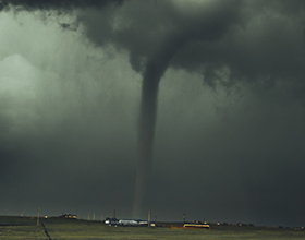
Current Radar and Conditions
Winter storm warnings and winter weather advisories have been posted by the National Weather Service from the mountains of southern California to parts of the Sierra, high country of Nevada and the mountains of northern and eastern Arizona.
Current Winter Alerts
(From the National Weather Service.)
Thissystem will produce mainly mountain snow in the West whilerain is likely in the lower elevations. Below is a general look at the timing through Wednesday.
Tuesday: Snow continues in parts of the Great Basin, extending into the Southern California mountains and northern Arizona. Snow levels will be quite low, falling to 2,000 to 2,500 feet in southern California. Wednesday: Snow showers may linger in thesouthern Rockies and Southwest before ending late in the day.
West Snowfall Forecast Through Wednesday AM
The heaviest additional snow totals will be found in the high country of southern California, where up to a foot of snow may fall.
This snow may impact travel in the Cajon Pass along Interstate 15 and at Sunrise Summit along Interstate 8 in the southern California mountains.
Arizona's Mogollon Rim may pick up to 6 inches of snow, as well.
(MORE:)
The southward dip in the jet stream will translate eastward into the Plains and Midwest late Wednesday and Thursday, steering the area of low pressure across those regions. That low may then gain some strength in the Great Lakes region.
Cold air will be limited, but some snow is expectedon the northern flank of the low-pressure system. The exact track of the system, stillremains a bit uncertain at this time.
Wednesday Night: Snowis possible in parts of Iowa, eastern Minnesota andWisconsin. Thursday-Thursday night: Snow, or rain changing to snow, and increasing winds may spreadacross eastern Minnesota, eastern Iowa,Wisconsin, northern Illinois during the day. Snow, or rain changing to snow, could then pushinto Lower Michigan, northern Indiana and northern Ohio Thursday night.
Snowfall accumulations in the Midwest and Great Lakes should remain modest, with most totals less than 6 inches through Thursday night or Friday.
Snowfall Forecast Through Thursday
Thursday night into Friday, a secondary area of low pressure will form and deepen off the Northeast Seaboard.
Thanks to a recent ,the weather pattern will be conducive for this low-pressure system to move slowly, potentially resulting in rain, some snow, strong winds and coastal flooding in the Northeast. The timeframe for those threats will be Thursday into Friday, potentially lingering into Saturday.
This is because of a westward shift ofblocking high pressure near Greenland, which can cause any low-pressure system to move slowly near or just off the East Coast and not move quickly out to sea.
An area of low pressure will intensify off the East Coast late this week, but its track and strength remain uncertain, which will determine impacts in the Northeast and mid-Atlantic.
There is still much uncertainty regarding the track or strength of this system.
However, one near certain impact will be high winds, coastal flooding and beach erosion along parts of the eastern New England coast, and eastern Long Island starting as soon as late Thursday, peaking Friday, then continuing into Saturday or even Sunday as the offshore low moves slowly.
With onshore north to northeast winds persisting over multiple high-tide cycles, coastal flooding and beach erosion will be most serious along north and northeast-facing beaches of eastern Massachusetts, including Nantucket Island, Martha's Vineyard, as well as parts of Long Island.
For now, most accumulating snowfall should remain in the interior Northeast Friday and early Saturday, with mainly rain near the I-95 corridor.
These high winds, combined with any wet snow, could lead to some tree damage and power outages, however, even if snowfall totals are modest.
Check back to weather.com for updates in the week ahead as we fine tune the details of this complicated forecast.


 zpostcode
 Recruit
 weather
 mreligion
 Yellowpages
 sport
sport constellation
 shopping
 name
name game
game directory
 literature
 Word
Word tour
tour furnish
 Lottery
 tftnews
 lyrics
 News
News digital
 car
car dir
dir Edu
Edu Finance


