

US
°C


Another round of snow is impacting the West through Wednesday.This system will target the Plains by Thursday.The Northeast will be impacted by late this week.
Sign up for the Morning Brief email newsletterto get weekday updates from The Weather Channel and our meteorologists.
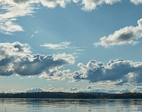
Another winter storm will bring heavy mountain snow to parts of the West, and a chance at snow for parts of the southern Plains and the Northeast by later this week.
This system has been named Winter Storm Quest by The Weather Channel.
Here's a look at what we expect from this next system.
Snow is currently falling in parts of the Cascades, Northern Rockies, and northern California. Rain and higher-elevation snow will continue through midweek in much of the West.
Additional feet of snow are expected to fall over the Sierra through mid-week, coming off the heels of Winter Storm Piper which impacted the state this past week. Blizzard conditions are expected through Wednesday morning. Heavy snow and gusty winds could create whiteout conditions. Avoid travel in the area.
By Wednesday, the heaviest of the snow and rain from this system will be centered over southern California and the southern Rockies.
Thursday: Quest will reorganize over the southern Plains by Thursday. Temperatures will shift from much above average to slightly below average in the Plains as this system moves through. Recent warmer-than-average temperatures could keep the ground warm enough that accumulations will be light.
Friday: A large band of snow and wintry mix will extend from the Plains to New England by Friday. The heaviest snow outside of the Rockies is expected from central Illinois into the Northeast and New England by Friday evening. The system will move offshore by Saturday afternoon and could bring some additional snow to the Northeast through Saturday morning.
West
The heaviest snow is expected in the mountains across much of the West, though some valleys could pick up light to moderate snow. In the Wasatch mountains of Utah, around two feet of snow is expected, with locally higher amounts of up to four feet possible.
In the Sierra, widespread totals of 6 to 20 inches of snow are expected, though some areas could see up to 6 feet of additional snow.
Plains, Northeast
There is still some forecast uncertainty for snow totals once Quest moves past the Rockies. For now, the highest snow totals outside of the Rockies extend from central Illinois into the Northeast and New England. Lighter snow is expected in the Plains, and warm ground temperatures should help keep accumulations light. Be sure to check back for more updates as this forecast evolves.
The Weather Company’s primary journalistic mission is to report on breaking weather news, the environment and the importance of science to our lives. This story does not necessarily represent the position of our parent company, .


 zpostcode
 Recruit
 weather
 mreligion
 Yellowpages
 sport
sport constellation
 shopping
 name
name game
game directory
 literature
 Word
Word tour
tour furnish
 Lottery
 tftnews
 lyrics
 News
News digital
 car
car dir
dir Edu
Edu Finance


