

US
°C


Parts of New York braced for yet another lake effect snow event that brought nearly 5 feet of snow to a town just east of Lake Ontario.
This additional snowfall was accompanied by yet another blast of bitterly cold wind as it slid across the northern U.S. The new cold surge whipped up a ground blizzard across parts of the Upper Midwest Thursday of last week.
A lake-effect snowband in Michigan played a role in a that occurred Friday morning near Battle Creek, Michigan on I-94.
(MORE: )
A cold front, in this case an , swept from the northern Plains Thursday to the Northeast Friday.
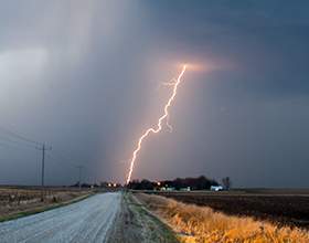
A quick burst of snow also fell as the clipper moved through the Northeast Friday morning, with 1.5 inches of snow reported in Central Park and around 4 inches in parts of northern Connecticut and southwestern Massachusetts. Winds also gusted over 60 mph on Nantucket Friday morning.
Snowfall totals were relatively minor across parts of the Dakotas, western and southern Minnesota and northern Iowa.
However, strong northwest winds gusting to 50 mph behind the arctic frontproduced widespread blowing snow in rural areas, reducing visibilities to near zero in some areas. The National Weather Service issued blizzard warnings for parts of those states Thursday.
Whiteout conditions were reported Thursday afternoon in much of the blizzard warning area. Blowing and drifting snow forced an 83-mile stretch of Interstate 35 to shut down between Ames and Clear Lake, Iowa, on Thursday evening. Travel was not advised on a number of roads in the eastern Dakotas, western and southern Minnesota, and northern Iowa on Thursday afternoon. At least 15 highways in southwest Minnesota were closed late Thursday, according to the Minnesota Department of Transportation.
Visibility fell to one block in De Smet, South Dakota, and 1 to 2 blocks in Brookings, South Dakota, according to the National Weather Service. In North Dakota, the customs and border patrol station along Interstate 29 at the Canadian border near Pembina was closed when Manitoba authorities shut down the highway on their side of the border. The road and border crossing have since reopened.
(INFOGRAPHIC: )
This is what's known as a "ground blizzard", one in which loosely-packed snow cover is whipped by the wind, reducing visibility in some areas despite little if any snow falling from the sky. The visibility was worst in open areas such as farm fields and prairies. In forested areas, as well as cities and towns where trees and buildings block the wind, visibility was generally not be as bad.
Compounding the danger are continued, brutal wind chills sinking into the 20s and 30s below zero.
(MORE: )
A beefy lake-effect snow event squeezed in on Monday, after and before . That lake-effect episode dumped a quick 28.5 inches of snow near Fulton, New York, which is in the Lake Ontario snowbelt in Oswego County.
After Gorgon moved away, another 23.5 inches of snow blanketed areas near Watertown, New York through Wednesday morning. A band of snow off of Lake Erie yielded 14.5 inches of snow in Elma, New York between 7 a.m. EST Tuesday and 7 a.m. Wednesday.
As you may recall, parts of the Buffalo Southtowns picked up 7 feet of snow in the Unlike that event, wind directions wobbled around quite a bit this week, preventing the sort of firehose effect where one band sets up and hammers the same area for a long duration.
Bands of heavy lake-effect snow also sagged southward over the Cleveland metro area briefly early Wednesday morning. In Michigan's Upper Peninsula, a stretch of M-28 between Marquette and Munising, Michigan was closed into Wednesday due to whiteout conditions.
Multiple snowbandsalso blanketed parts of northern and western Lower Michigan into northern Indiana. Eleven inches of snow was measured near New Era, Michigan. Several other locations picked up over 6 inches of snow, including Grand Haven (8 inches).
The above-mentioned clipper deposited a broad area of snow in the Great Lakes and Northeast Thursday into the first half of Friday.
Thundersnow was even reported early Friday morning near Buffalo and 12.5 inches was reported just north of Buffalo through 8:00 a.m. Friday.
Then, cold winds blowing over the Great Lakes kicked in lake-effect snowbands in many of the same Great Lakes snowbeltsthat have been blanketed already this week.
Select snowfall totals for locations east of Lake Erie:
- 20 inches in East Aurora- 19 inches in Hamburg- 16 inches in Angola on the Lake- 12 inches near Buffalo
Select snowfall totals for locations east of Lake Ontario:
- 54 inches in Rodman- 48 inches in Adams- 35 inches in Beaver Falls- 25 inches near Watertown
As touched on already, strong winds both ahead of and behind the "Alberta clipper" cold front will also lead to areas of blowing snow, reduced visibilities and dangerous travel conditions.
Gov. Andrew Cuomo announced the shutdown of the between Ripley and Henrietta in western New York, including the Buffalo metropolitan area, and much of Interstate 190 in the Buffalo area as well. The closures took effect at 9 p.m. Thursday for trucks and at midnight for all traffic. As of early Saturday morning I-90 remained closed between Ripley and Downtown Buffalo.
(INTERACTIVE: )
Senior meteorologist Nick Wiltgen contributed to this report.
MORE ON WEATHER.COM: Epic Lake-Effect Snow Buries Buffalo, November 2014


 zpostcode
 Recruit
 weather
 mreligion
 Yellowpages
 sport
sport constellation
 shopping
 name
name game
game directory
 literature
 Word
Word tour
tour furnish
 Lottery
 tftnews
 lyrics
 News
News digital
 car
car dir
dir Edu
Edu Finance


