

US
°C


Lidar can help create 3D maps that show the size and shape of objects.
(NASA)
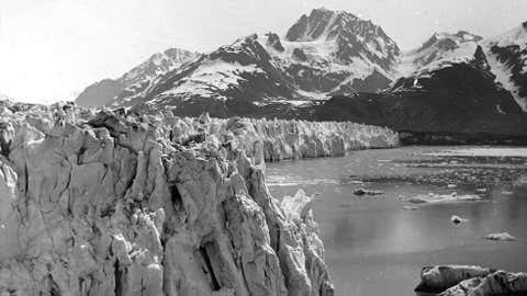
Cultural, environmental and geological treasures are already being lost to climate change.Using Lidar, a scientist wants to create a 3D map of all the land on Earth.He also wants to create a repository to share data will all researchers.
Using lasers aboard planes, a Colorado State University archaeologist wants to scan the entire surface of the Earth and create detailed digital maps of all its treasures.
Chris Fisher is racing against time. Climate change is already altering many of the features Fisher wants to record.
“We are going to lose a significant amount of both cultural patrimony – so archaeological sites and landscapes – but also ecological patrimony – plants and animals, entire landscapes, geology, hydrology,” Fisher told the Guardian. “ before the Earth fundamentally changes.”
Fisher's plans call for using Lidar: Light Detection and Ranging. It's like radar that uses a laser beam instead of radio signals. Equipment measures how fast the laser beams bounce back. Combine results from millions of beams and you get a 3D map of features on the ground.
“We can see things on the ground that are on the order of 20cm [8.5 inches] or so … which is about the size of a construction brick,” Fisher said.
The idea is not new. Researchers using Lidar that previously went undetected in a dense jungle in Guatemala.
Taking a lead from , a non-profit organization that maps cultural monuments and sites in 3D, Fisher created .
Earth Archive's mission is to record how the land looks now, track how climate change is affecting it and make the information freely available to other scientists and to future generations.
Fisher said the first areas to be recorded will be those most under threat, such as the Amazon that's being deforested and coastal regions at risk of rising sea levels.
He says it would cost about $15 million to scan much of the Amazon within two or three years.


 zpostcode
 Recruit
 weather
 mreligion
 Yellowpages
 sport
sport constellation
 shopping
 name
name game
game directory
 literature
 Word
Word tour
tour furnish
 Lottery
 tftnews
 lyrics
 News
News digital
 car
car dir
dir Edu
Edu Finance


