

US
°C


Mississippi's Big Sunflower River is the 2018 most endangered river in the United States.
(American Rivers/John Ruskey)
The river advocacy group American Rivershas been rating U.S.rivers since 1984.Selections for theendangered list are primarily based on whether a major policy decisionis in the works about a river forthe coming year.
A river advocacy group has announced its 10 most endangered rivers list for 2018.
American Rivershas been rating the most endangered U.S.rivers since 1984 and releases to help local communities protect and save their threatened rivers.
Selections for theendangered list are primarily based on whether a major policy decisionis in the works about a river forthe coming year. Other factors include the significance of the river to human and natural communitiesand the magnitude of the threat to the river and nearby communities, especially in light of climate change.
The report "encourages decision-makers to do the right thing for the rivers and the communities they support. It presents alternatives to proposals that would damage rivers, identifies those who make the crucial decisions, and points out opportunities for the public to take action on behalf of each listed river."
Here is the countdown of this year's list, released Tuesday:
A snowy scene at Wisconsin's Kinnickinnic River.
(American Rivers/Michael Page)
In the heart ofthe Minneapolis-St.Paul metro area lies the Kinnickinnic River, a popular kayaking and trout fishing destination that draws not only the 35million people that call the metropolis homebut people from across Wisconsin and the Midwest.
Two dams on the "Kinni," the Upper and Lower dams, support an outdated hydroelectric facility that interrupts the flow of the river, increases water temperature and impact wildlife, includingtrout, macroinvertebrates and mussels.
The dams block off a mile of the river, a stretch that would otherwise feature a "beautiful drop of cascades and waterfalls."
The report notes that the plant produces only 2 percent of energy needs for the city of River Falls, home to 15,000, and the dams provideno other purpose other than to support the plant.
Despite the city's acknowledgmentin February that the dams should be removed at some point to return that stretch of river to its original state, itis now considering the extension of the facility's licensewith the Federal Energy Regulatory Commission (FERC) for thecontinued operation of the Upper Dam.
"Their current plan is to remove the Lower Dam in 2023 and postpone the removal of the Upper Dam until a target date of 2040," the report noted."This more than 20-year delay in the complete restoration of the Kinnickinnic River is unacceptable."
Illinois' Middle Fork Vermilion River.
(American Rivers/Pam Richart)
The Middle Fork Vermilion River in east-central Illinois is threatened by a coal-fired power plant that closed several years ago but continues to leachcoal ash into the river system.
The river surrounded by public lands is a popular recreational site in the heart of the Kickapoo State Park. Millions of visitors flock to the park to enjoy angling, photography and wildlife viewing, or to swim in or tube down the river on hot summer days.
In 2011,Dynegy closed the Vermilion Power Station, which sits on a bluff above the river. Upon closure, the company left behind3.3 million cubic yards of coal ash produced over its 55-year operating life, whichwas dumped into three massive pits in the floodplain below. These unlined pits allow the coal ashto seepinto the river via groundwater.
According to the report,coal ash can contain contaminants including "arsenic, barium, boron, chromium, iron, lead, manganese, molybdenum, nickel and sulfate, which are known to cause birth defects, cancer and neurological damage in humans and can harm and kill wildlife, especially fish."
(MORE:)
Instead of remediating, the company has sought permission to build bank stabilization structures andthen cap and leave the coal ash pits.
"Simply capping an unlined ash pit will not stop the groundwater contamination, nor can the armoring prevent the eventual failure from the erosive force of the river," the report says. "In fact, as climate change brings higher and more frequent peak flood flows, the chance of failure is only increasing."
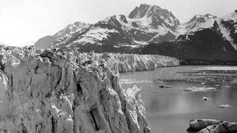
8. Colville River, Alaska
The Colville River meanders through the Alaska landscape.
(American Rivers/Jason Leppi)
The Colville River in northern Alaska is threatened by oil and gas development,which "greatly threatens the places, wildlife and people that make this region so ecologically and culturally important."
Known as one of the wildestin the United States, the river flows through the 22.8-million acre National Petroleum Reserve, which hosts a landscapethat is considered one of the most ecologically intact unprotected areas on the planet, the report notes. Its size is 10 times larger than Yellowstone National Parkand is the largestfederal land reserve in the country.
It has remained largely uninhabited and has five special areas, including the Colville River Special Area, that are designated for their "high conservation and subsistence values." The region is also home topolar bears, wolves and caribou.
The Trump administration has set its eyes on the special areas in alignment with its energy policies and has leased out significant portions of land along the lower Colville River for oil development.
"The administration plans to deconstruct the Colville River Special Area and the associated management plan and best management practices developed to protect this waterway," says the report. "These rollbacks have the potential to compromise this river’s conservation values while subjecting this vulnerable Arctic waterway to substantial degradation."
7. Smith River, Montana
A summer day on Smith River in Montana.
(American Rivers/Fish Eye Guy Photography)
A proposed copper mine threatens the 60-mile river that flows through a spectacular limestone canyon between the Little Belt and Big Belt Mountains in the heart of central Montana's Lewis and Clark National Forest.
Nationally renowned among anglers forits brown and rainbow trout fishery, the river is also home tobald and golden eagles, osprey, moose, elk, mule and whitetail deer, black bearand even the occasional grizzly bear.
An Australia-based firm, Sandfire Resources America, is proposing to develop an underground copper mine beneath one of the most productive trout spawning streams in theSmith River system, Sheep Creek.
"Removing copper from the ground poses serious environmental risks," American Rivers said. "The copper lies in a massive sulfide-ore body, which, when exposed to air and water, produces acid mine drainage. There is also the likelihood that the mine will leach toxic heavy metals, such as mercury, lead and arsenic into nearby surface waters."
In addition, the mine would require water pumped out Sheep Creek, which would imperil the trout spawning grounds.
A canoe race on the Mississippi River Gorge, in Minnesota.
(American Rivers/Greg Lais)
The Mississippi River Gorge, inthe heart of downtownMinneapolis, is threatened by locks and dams that prevent the revitalization of river health and recreation.
The U.S. Army Corps of Engineers is currently studying two locks and dams on the 8-mile stretch of river to determine whether the continued maintenance and operation of the structures is "in the taxpayers’ best interest."
"If the Army Corps decides to keep the dams in place, aquatic habitat in the Gorge could continue to decline for a generation or more," the report notes. "On the Upper Mississippi River, habitat is degrading faster than it can be restored through existing conservation programs, and the river’s dams are a primary cause of declining aquatic habitat. The stretch around Saint Anthony Falls was once one of four big river rapids on the Upper Mississippi. Today, a lone remnant of the St. Louis Chain of Rocks rapids is all that remains."
The South Fork Salmon River in Idaho.
(American Rivers/Daneil Patrinellis)
The 86-mile South Fork Salmon River incentral Idaho is threatened by miningthat could have lasting consequences for clean water.
Designated as a critical habitat for endangered chinook salmon and steelhead and threatened bull trout, the river has suffered over the years from extensive logging and the construction of roads, along with heavy metal contamination from mining.
(MORE: )
In recent years,$13 millionspent on restoration and reclamation at Stibnite, one of the original mining sites, has allowed levels of arsenic, mercury and antimony in the surrounding creeks and rivers to decrease.
Today, Midas Gold has submitted plans to the U.S. Forest Service to reopen and expand its mining operation at Stibnite.
"This project would unearth more arsenic, mercury and antimony that, through natural processes, such as acid mine drainage, and potential accidents and spills, would deposit directly or indirectly into the South Fork of the Salmon River, jeopardizing the protected Main Salmon River and endangered fish downstream," the reports notes.
Steam rises from the Lower Rio Grande, in Texas.
(Courtesy of the River and the Wall)
The Lower Rio Grande in South Texas isthreatened by a border wall proposed by U.S. President Donald Trump, which would "cut off people and communities from the river, exacerbate floodingand destroy wildlife habitat."
According to the report, the 1,200-mile border section of the Rio Grande plays a critical role for ecosystems protected by Big Bend National Park, the Lower Rio Grande Valley National Wildlife Refuge, Santa Ana National Wildlife Refuge and major state parks, as well as major conservation areas in Mexico.
"All of this is precariously balanced on the flows and management of the river by the U.S. and Mexico, and threatened by mismanagement and border walls," the report says.
A maze of water at Boundary Waters, Minnesota.
(American Rivers/Jim Brandenburg)
The Boundary Waters in northeastern Minnesota are threatened by mining that would pollute pristine waters and harm a thriving recreation economy.
Running through the Boundary Waters and the Superior National Forest is the Kawishiwi River, an important canoe route enjoyed by tourists and enthusiasts. The water systemand lakes are protected for Native Americanunder an 1854 Treaty.
"People, fish and wildlife, including walleye, northern pike, smallmouth bass, wolves, lynx, moose, bear, loons, bald eagles and osprey, all benefit from the clean water that the Boundary Waters provides for drinking, recreating and refuge," the report says.
Now, foreign-owned Twin Metals/Antofagasta proposes a massive, sulfide-ore copper mine on the banks of, and under, the South Kawishiwi and Birch Lake. The report notes that hardrock mine which is reportedly the most toxic industry in America.
American Rivers adds that there are numerous studies that say sulfide-ore copper mining would cause considerable harm to the South Kawishiwi and the Boundary Waters.
"More than 99 percent of the sulfide-bearing rock extracted from hardrock mining would be waste," the report says. "When air and water contact such waste rock, acid mine drainage (sulfuric acid, heavy metals and sulfates) is released."
A mama grizzly bear and her cubs at the rivers of Bristol Bay, Alaska.
(American Rivers/)
The rivers of Bristol Bay, including the Nushagak and Kvichak rivers, are threatened by what could become the world’s biggest open-pit mine.
The river system is home to one of the "last great wild salmon runs in the world." It also boastsworld-class rainbow trout, char and other freshwater fish.
(MORE:)
The proposed Pebble Mine project could "create 10 billion tons of waste, consume 35 billion gallons of freshwater per year, and include a four-mile long dam taller than the Hoover Dam," American Rivers notes in its report.
"Pebble Mine would create approximately 1,000 temporary mining jobs, while indefinitely threatening 14,000 fishery jobs," according to the report.
Sunset on the Big Sunflower River.
(American Rivers/Stephen Kirkpatrick)
The #1 most-endangered river for 2018 is one of the main tributaries of the Yazoo River in western Mississippi. It is threatened by therevival of the Army Corps of Engineers Yazoo Pumps project, a project American Rivers says would "drain critical wetlands at enormous taxpayer expense."
According to the report, the wetlands of the Big Sunflower in central Mississippi are“some of the richest wetland and aquatic resources in the nation."
Under protections of the Clean Water Act, the state-listed Louisiana black bear has made a comeback and has been removedfromthe federal endangered species list.
Today, members of Congress are pushing to resurrect the Yazoo Pumps project, which is considered one of the most environmentally damaging projects ever proposed by the U.S. Army Corps of Engineers, the report says. If it the project advances, it would be the first timean EPA veto of a Corps project was overturned by Congress.
The project is said to have been initially authorized in 1941 to help reduce backwater flooding between the Mississippi and Yazoo Rivers just north of Vicksburg, Mississippi.
"In reality, this is an agricultural drainage project that would benefit highly subsidized big agribusiness while increasing flood risk downstream and harming low-income communities that depend on the area’s natural resources," the report says.


 zpostcode
 Recruit
 weather
 mreligion
 Yellowpages
 sport
sport constellation
 shopping
 name
name game
game directory
 literature
 Word
Word tour
tour furnish
 Lottery
 tftnews
 lyrics
 News
News digital
 car
car dir
dir Edu
Edu Finance


