

US
°C


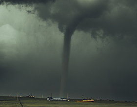
The peak of winter storm season is almost upon us. Several great snowstorms have impacted the Midwest and Northeast during the period between late January and early February. Storms during this period can drop feet of snow and cause wind gusts to climb over 50 mph.
You might be hoping that winter is almost over due to this year's Arctic Invasion, but just wait - there's more on the way.
In fact, the peak of winter storm season is just around the corner. The end of January and the beginning of February can have some high impact winter storms.
(MORE: )
Winter storms can occur from October to May, but they become most frequent in the first week or so of February. This has no direct relationship between when the strongest storms of the season occur, but it does give us a great idea of when snow plow drivers, flight reschedulers and ski resorts will be the busiest ... and when the kids will be happiest to watch the news.
Winter storm climatology, 2013-2017.
(Tom Niziol, The Weather Channel Winter Storm Expert)
This is your reminder to getprepared to stay aware of the weather forecast, as winter may still have a lot to show us.
Several monsterwinter storms have occurred in this period, including two major blizzards in 1978 and, more recently, Winter Storms Juno and Niko.
(MORE:)
Let's take a look at a few of these storms starting with the epic blizzards in 1978:
The first so-called blizzard of 1978 rocked parts of the Upper Midwest and Ohio Valley.Citizens in central Indiana still measure whether a storm is bad or not based on how it compares to this storm. Many meteorological records from this storm exist to this day.
This cyclone went by numerous names in the National Weather Service and media, some of which include "The Cleveland Superbomb" and the "White Hurricane."
Some accounts say that as many as in this storm.
Winds gusted to more than across Indiana and visibility remained below one quarter mile for 25 hours, easily besting the requirement to be a blizzard. In southern Michigan, wind , and similar gusts were reported in Ohio. Wind chills in the region dropped as low as . Motorists and evenWeather Service workers got around by means of snowmobiles and skis for days. Indiana statepolice on the 26th of January. Some roads near Toledo, Ohio, didn't reopen for .
Much of the state was shut down for several days while Ohioans labored to clear roads, driveways, and sidewalks. The plowed drifts in this image from Marion county are more than twice the height of the car.
(NWS Cleveland and the Marion Historical Society)
The Great Blizzard of '78 was rated a Category 5 snowstorm on NOAA's due to its extreme impacts across Indiana, Michigan and Ohio, where snow was measured in feet. "Snow from the storm continued to blanket the area for two months," .
The Cleveland Superbomb was a name given to this low pressure system because of how fast the barometric pressure dropped as it reached the Midwest. Pressure dropped 40 millibars in about 24 hours, crushing low-pressure records across the Midwest. Many continue to be held by this storm, which stretched from Georgia to Vermont.
Pressure records set by the Great Blizzard of 1978/the Cleveland Superbomb.
(David Roth/Weather Prediction Center and Christopher Burt/Wunderground)
(MORE:)
Less than two weeks later, a second, even more notable blizzard struck the United States, this time in the Northeast. This,too, is a benchmark storm for the region that it hit. The winter of 1978 was especially notable for the Northeast due to a number of strongand winter storms that led up to this particular blizzard.
Remember in 1978 that satellite and radar technology was largely in its infancy, and forecast busts were far more common than they are today. A poorly forecasted storm in mid-January of 1978 led residents of the major cities of the northeast to leading to this major winter storm. Many underestimated the power of the Blizzard of '78 for this reason ... and soon got stuck in it.
(MORE:)
When this storm arrived in southern New England, it was met with bitterly cold air to the north anda stationary high pressure system, or blocking high, over Greenland. This forced a very long-duration blizzard to occur over southern New England for 36 hours.
The New England Blizzard of '78 was rated a Category 5 snowstorm on NOAA's due to its extreme snowfall and winds across Rhode Island and Massachusetts.
: 27.1 inches in Boston, 38 inches in Woonsocket, Rhode Island, 27.6 inches in Providence, Rhode Island, and 16.9 inches in Hartford, Connecticut. One unofficial but NWS-recognized report listed a snowfall total of 55 inches in Lincoln, Rhode Island! Snow driftswould have reached halfway up the third story of some buildings.
Several one-, two- and three-day snowfall records from this blizzard continue to exist to this day in and.
Cars lost in the snow on Farragut Road in South Boston.
(http://www.blizzardof78.org/)
Besides the snow raging on shore, the sea was also ravaging homes and landmarks near the coast, in many spots for 2-4 high tide cycles which included the highest tides of the month. These tide records stood for 40 years until Winter Storm Grayson bombed off the east coast in January of 2018.
Wind gusts in eastern Massachusetts were reportedly as high as 93 mph in Chatham and 79 mph in Boston. Some suggest wind gusts over 110 mph occurred, but these are unverified.
According to NWS Boston, 99 people were killed in the storm, 73 in Massachusetts and 26 in Rhode Island. . Around were stranded or abandoned in parts of Rhode Island and Massachusetts, and 2,000 homes were destroyed across New England. Some schools and businesses were closed for a week.
Houses thrown about on the South Shore.
(Blizzardof78.org)
, including the Fo'Castle from "Outermost House" novel by Henry Beston, which was carried away by waves, and a fishing shack called Motif #1 in Rockport, Massachusetts, which was obliterated by destructive winds.
For more photos of this historic blizzard, visit
(MORE: )
A more recent example of a strong winter storm that happened near the peak of winter storm season comes from Juno, which struck much of New England with more than two feet of snow. .
The main impact of Juno's wrath on the Northeast was on travel. While blizzard conditions were not seen in New York City as forecast, the , and domestically and internationally were cancelled. Boston's were closed during the storm.
One-day snowfall records were set in parts of ,and . A swath of 30+ inches of snow was recorded from the eastern end of Long Island to southern Maine.At least 54 locations in six states from eastern Long Island to New England reported more than 30 inches of snow.
A man uses a snow blower to remove the snow around a home on Spring St. in New Bedford, Mass. on Tuesday, Jan. 27, 2015.
(AP Photo/The Standard-Times, Peter Pereira)
Juno, also called the Blizzard of 2015, was rated a Category 3 snowstorm on NOAA's due to its major impacts in eastern New England.
(MORE:What Is Your Snowiest Month of the Year?)
The storm produced wind gusts over 70 mph and up to 5 feet of storm surge in parts of eastern Massachusetts.Structural damage from coastal flooding occurred particularly during the early morning high tidein Marshfield, Plymouth, Sandwich and Scituate, Massachusetts. In Scituate, the was sent out to rescue people, and for some in southern New England, power was purposefully cut for the fear of fires breaking out or electrocution in flood waters.
In parts of the South Shore of eastern Massachusetts, by ferocious waves.
Water floods a street on the coast in Scituate, Mass., Tuesday, Jan. 27, 2015.
(AP Photo/Michael Dwyer)
Juno largely went on without taking human life, but at least was reported.
Of course, winter storms can occur well into April and May, so stay tuned with us here at weather.com for your latest forecast.


 zpostcode
 Recruit
 weather
 mreligion
 Yellowpages
 sport
sport constellation
 shopping
 name
name game
game directory
 literature
 Word
Word tour
tour furnish
 Lottery
 tftnews
 lyrics
 News
News digital
 car
car dir
dir Edu
Edu Finance


